
Direct Answer: Coastal lots in Monterey County involve variable soils, strict drainage requirements, and a grading permit process that can require a geotechnical report and drainage study before a single shovel hits the ground.
A developer recently reached out to us about a lot near the corner of Martin and Bayview in Carmel. The scope they described was straightforward on paper: cut and grade the site, haul off roughly 500 cubic yards of excess dirt, build a driveway approach, construct a retaining wall, install a drainage system, and possibly pour a foundation. That’s a complete site development checklist. But on a coastal Monterey County lot, every single one of those tasks carries complications you won’t find on a flat Salinas Valley parcel or a Sonoma County hillside.
I’ve worked enough sites across this county to know that the terrain here doesn’t behave the way most people expect. The soil profiles shift from decomposed granite to coastal clay sometimes within the same lot. The drainage requirements are stricter than inland. And the permit process for a project at that scale involves documents that can take weeks to prepare before the county will even review your application.
This article walks through what makes coastal Monterey County site prep genuinely different, what the soil does, what the permit process actually looks like at this scale, and why discovering a floodplain issue before you hire an architect can save you tens of thousands of dollars.
What the Soil Actually Does on a Coastal Monterey Lot
Inland sites in the Salinas Valley are mostly flat and predictable. You grade to plan, compact the subgrade, and move on. Coastal lots above and around Carmel, Pebble Beach, and the hillsides overlooking Monterey Bay are a different conversation.
Decomposed granite is common in the upland areas near Carmel and Pebble Beach. It feels solid when it’s dry, but it breaks apart under load and doesn’t compact the same way dense native soil does. Mix that with pockets of coastal clay, which expands when wet and shrinks when dry, and you can have two very different bearing capacities within the same building pad. That’s not a theoretical problem. It’s something I’ve seen in the field, and it’s exactly why a geotechnical report isn’t just bureaucratic paperwork on a coastal lot. It tells you what’s actually under your feet.
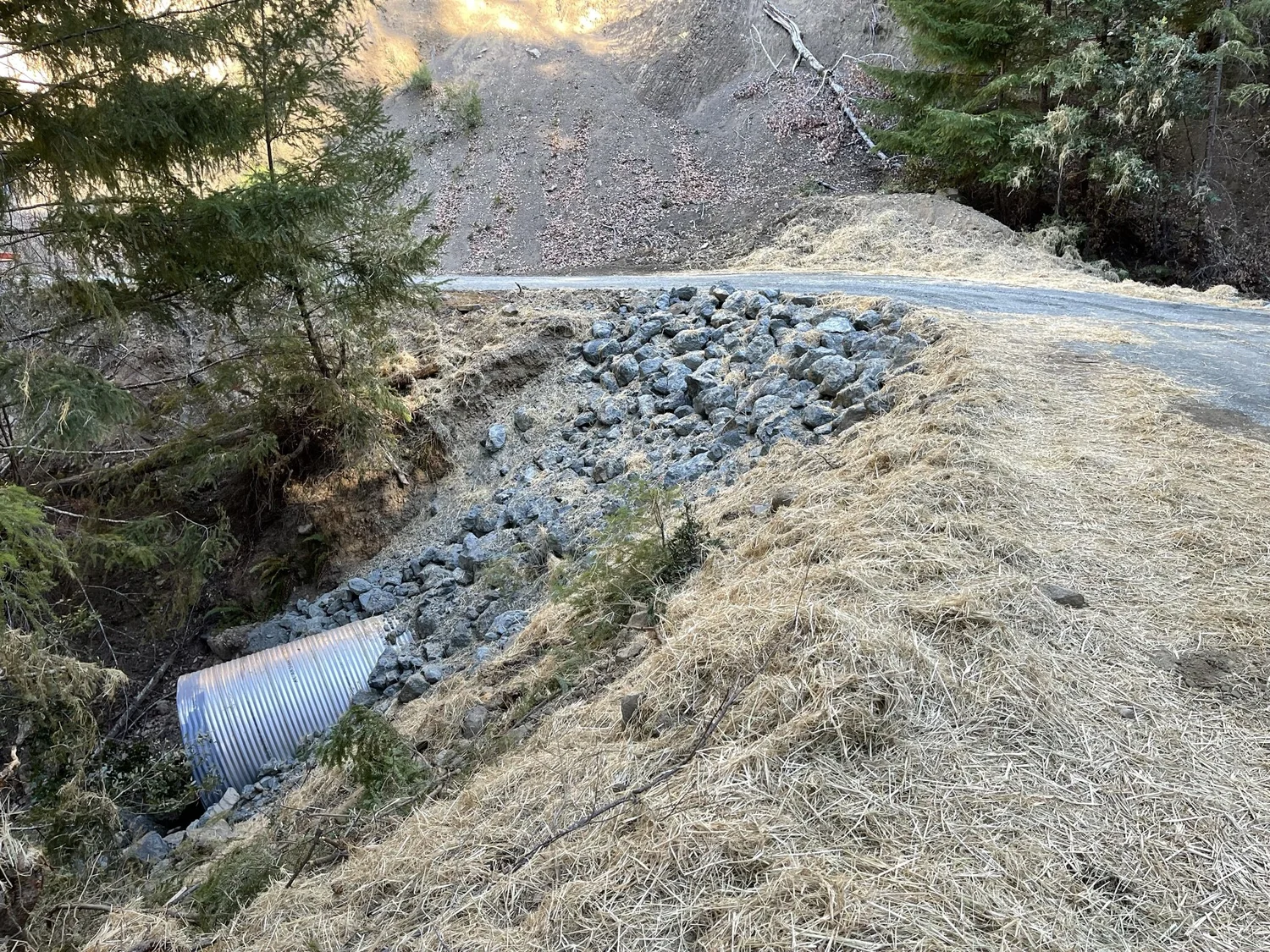
On steeper parcels above the Monterey coastline, slope stability is the first question. Any cut into a hillside exposes soil that was previously held in place by vegetation and lateral pressure. Once that’s disturbed, especially during the wet season, erosion can move fast. Monterey County’s erosion control requirements kick in on projects disturbing more than a threshold acreage, and those requirements specify what physical measures have to be in place before rain hits the site.
For a project like the Carmel submission we received, with 500 cubic yards of haul-off and a retaining wall in the scope, grading sequencing matters a lot. You don’t strip the whole site at once. You work in phases so exposed soil is stabilized before you move to the next cut. The drainage outfall design also has to be set before grading starts, not figured out afterward. What a site plan actually controls is a longer conversation, but on a coastal lot it comes down to: water has to go somewhere specific, and that somewhere has to be engineered before dirt moves.
What the Monterey County Grading Permit Process Looks Like at This Scale
Monterey County’s grading permit threshold is 100 cubic yards of cut or fill. A project hauling off 500 cubic yards clears that threshold easily. Once you’re above it, you’re not just filing a simple form, you’re submitting a full permit application that the county reviews before issuing approval.
For a project at this scale on a coastal lot, that application typically includes:
- A grading plan stamped by a licensed civil engineer
- A soils or geotechnical report prepared by a licensed geotechnical engineer
- A drainage study showing how stormwater will be managed on the site and where it discharges
- An erosion and sediment control plan meeting Monterey County’s NPDES requirements
- Site location and parcel information, plus any environmental constraints identified
The geotechnical report alone can take two to four weeks to prepare once the engineer has done their site investigation. The drainage study adds more time depending on complexity. Then the county reviews the complete package, which can take additional weeks during busy permitting seasons.
What this means practically: if you’re planning a project with a spring or summer start date, you need to be initiating the site assessment and engineering work in the fall or winter before. Developers who come to us in March hoping to break ground in April on a project this size are usually looking at a realistic start date somewhere in late summer at the earliest.
Sonoma County’s threshold, by comparison, is 50 cubic yards, half of Monterey’s, so the bar to trigger permitting is lower there. But Monterey’s permit process at scale is no less thorough once you’re in it. If you want a deeper look at what foundation work specifically demands in this county, this breakdown of foundation excavation in Monterey County covers the field conditions in detail.
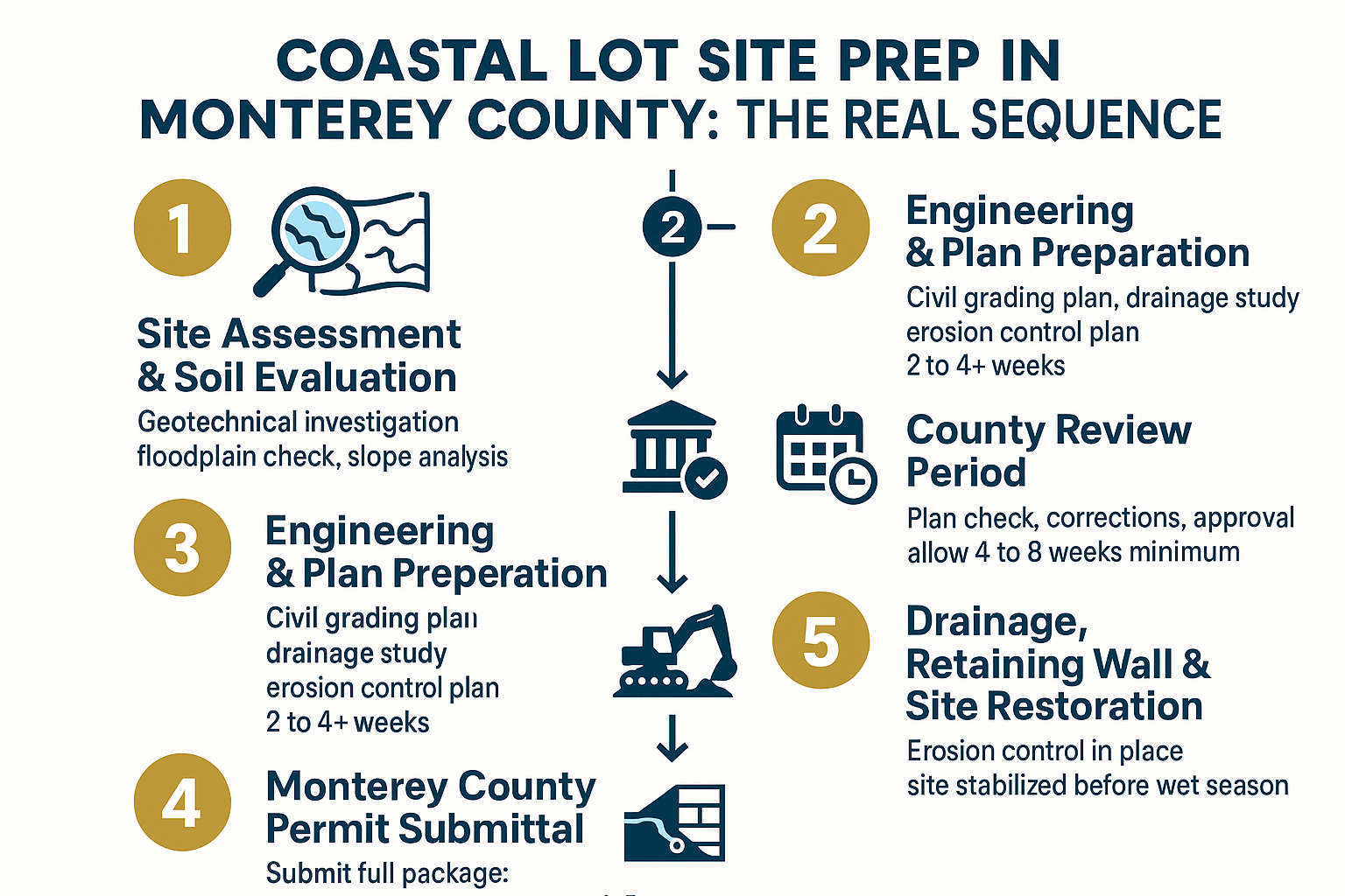
Monterey County Coastal Site Prep: From Raw Lot to Ready-to-Build
This shows the realistic sequence of steps for a full coastal site development project in Monterey County, from initial site assessment through grading permit approval and field work.
The Floodplain Question, and Why You Want the Answer Before You Hire an Architect
This is the part of coastal Monterey site planning that catches property owners off guard more than almost anything else.
Some lots near Carmel Bay, along the Carmel River corridor, and in coastal-adjacent low-lying areas fall within the FEMA 100-year floodplain. In Monterey County, new development and improvements in those designated zones require review and approval from the county’s Housing and Community Development department before construction permits can be issued. Structures in those areas have to be built to floodplain management standards, which affects foundation design, finished floor elevation, and sometimes the entire site development approach.
The mistake I see people make is spending money on architect drawings and civil engineering before anyone has checked whether the lot is in a regulated flood zone. If it is, some of that design work may need to be redone once the floodplain requirements are understood. A basic site assessment, walking the property, reviewing the county’s flood maps, and identifying any environmental constraints, costs a fraction of what redesign costs later.
FEMA’s flood maps are publicly searchable, but reading them correctly for a specific parcel takes experience. Coastal lots especially can sit right on the boundary of a flood zone, and whether your building area falls inside or outside that line matters a great deal. We had a similar situation come up when we wrote about how FEMA flood remapping affects site work in Sonoma County, the same principle applies in Monterey, and coastal proximity makes it even more relevant here.
For properties in Carmel Valley, the terrain shifts. You’re working with a river corridor that has its own flood history, and lots further up the valley toward the hills have steeper slope profiles and different soil behavior than the parcels closer to the coast. The site assessment process differs meaningfully between a coastal Carmel lot, a Carmel Valley parcel, and a hillside site above downtown Monterey. Knowing which set of conditions you’re working with before engineering fees start is what separates a project that moves on schedule from one that stalls.
Coastal vs. Inland Site Prep: Key Differences in Monterey County
These are the practical differences that affect planning, timeline, and cost on a coastal Monterey lot compared to a flat inland site like the Salinas Valley floor.
| Factor | Coastal Monterey Lot | Inland / Salinas Valley Lot |
|---|---|---|
| Soil Type | Decomposed granite and coastal clay, variable within same lot | Sandy loam or alluvial soil, more uniform |
| Grading Permit Threshold | 100 cubic yards (same county-wide) | 100 cubic yards (same county-wide) |
| Geotechnical Report Required | Typically yes at scale, often required by county | Depends on project scope and slope |
| Drainage Design Complexity | High, erosion risk, coastal proximity, outfall must be engineered | Lower, flatter terrain simplifies surface drainage |
| Floodplain Risk | Elevated near bay and river corridors | Lower on elevated valley floor, higher near Salinas River |
| Erosion Control Requirements | Strict, wet season exposure on disturbed slopes is high-risk | Less acute on flat terrain with gentle grades |
| Site Sequencing | Phased cuts required to protect slope stability | Larger areas can often be graded in fewer passes |
What a Full Coastal Site Prep Scope Actually Involves, Field to Finish
The Carmel submission we received is essentially a textbook example of what full site development on a coastal lot looks like. Let me walk through each piece of that scope and what it means on the ground.
Cut and grade the site. On a sloped coastal lot, this means deciding what stays and what moves. The civil engineer’s grading plan defines the cut and fill areas, but an experienced excavation crew has to execute that plan in the right sequence so you’re not creating instability as you go. Our grading work follows a plan, not feel, and that matters more on a coastal slope than anywhere else.
Haul off 500 cubic yards of excess dirt. At that volume, you need a plan for where the material goes before the first load leaves the site. Some of it may be usable as fill elsewhere on the property. The rest has to go to an approved disposal or reuse site. Coordinating that haul during permit-required grading means every load is documented.
Build a driveway approach. On a coastal hillside lot, the driveway approach isn’t just paving prep. The subgrade has to handle drainage from above and be stable enough that the first wet season doesn’t wash it out. Why Monterey driveways crack faster than expected comes down almost entirely to what’s done, or not done, at the subgrade level.
Retaining wall excavation. The wall holds back the grade change. But the excavation behind that wall, and the drainage behind it, matter as much as the wall itself. Water trapped behind a retaining wall without proper drainage is what causes walls to fail. Getting retaining wall excavation right on a slope starts with the cut, not the concrete.
Drainage system installation. On a coastal lot, the drainage design has to account for where water is coming from upslope, how it moves across the graded site, and where it discharges safely. Why drainage trenching fails usually traces back to a system that was designed as an afterthought rather than built into the site plan from the start.
Foundation prep. If the foundation is in scope, it comes last, after the grade is stable, drainage is working, and the building pad has been properly compacted to plan. Rushing to this step before the site is ready is exactly what causes foundations to fail before a home is finished.
Frequently Asked Questions About Coastal Lot Site Prep in Monterey County
Do I need a geotechnical report for every grading project in Monterey County?
Not for every project, but once you’re above the 100 cubic yard permit threshold, and especially on a sloped coastal lot, the county will often require one as part of the permit application. On a coastal hillside with decomposed granite or variable clay, a geotech report is worth getting regardless of whether the county requires it. It tells you what’s under the building pad before your foundation design is locked in.
How long does the Monterey County grading permit process take for a large project?
For a project with 500 cubic yards of haul-off and a full site development scope, you’re looking at a realistic front-end timeline of 2 to 4 months from the start of engineering work to permit issuance, sometimes longer depending on county review backlog, the number of plan check correction rounds, and how complete your submittal package is on the first try. Getting the documents right the first time matters a lot here.
What is the difference between a Carmel coastal lot and a Carmel Valley lot when it comes to site prep?
Coastal lots near Carmel Bay tend to have more decomposed granite in the upland areas, steeper slopes in some cases, and higher erosion risk because disturbed soil near the coast is exposed to more moisture. Carmel Valley lots are typically inland enough to have different soil profiles and different drainage patterns, but they sit along a river corridor with their own flood zone considerations. The site assessment approach differs between the two, even though they’re in the same county.
How do I find out if my lot is in a FEMA flood zone?
FEMA publishes its Flood Map Service Center online, and you can search by address. But reading the maps accurately for a specific parcel, especially one that sits near a flood zone boundary, takes experience. A site assessment early in the planning process will flag this before you’ve spent money on architectural drawings.
Can I do site prep work during the rainy season in Monterey County?
You can, but the erosion control requirements become more demanding. Monterey County requires specific measures on active grading sites during the wet season, silt fencing, straw wattles, stabilized construction entrances, and sometimes more intensive slope protection. Working during the dry season gives you more flexibility, but plenty of projects run year-round when the site conditions and permit allow it.
Planning a Coastal Lot Project in Monterey County?
If you’re working through a site development project in Carmel, Pebble Beach, Seaside, or anywhere along the Monterey County coast, we’re available to walk through the scope with you before engineering fees start adding up. Call us at 707-601-9091 or reach out through the contact form at dw-excavation.com, we’re familiar with the terrain, the permit process, and what it actually takes to get a coastal lot ready to build.