
Direct Answer: FEMA’s January 2026 flood map update places roughly 2,500 Santa Rosa properties in high-risk flood zones, triggering new drainage, grading, and foundation elevation requirements for anyone building or making major site improvements.
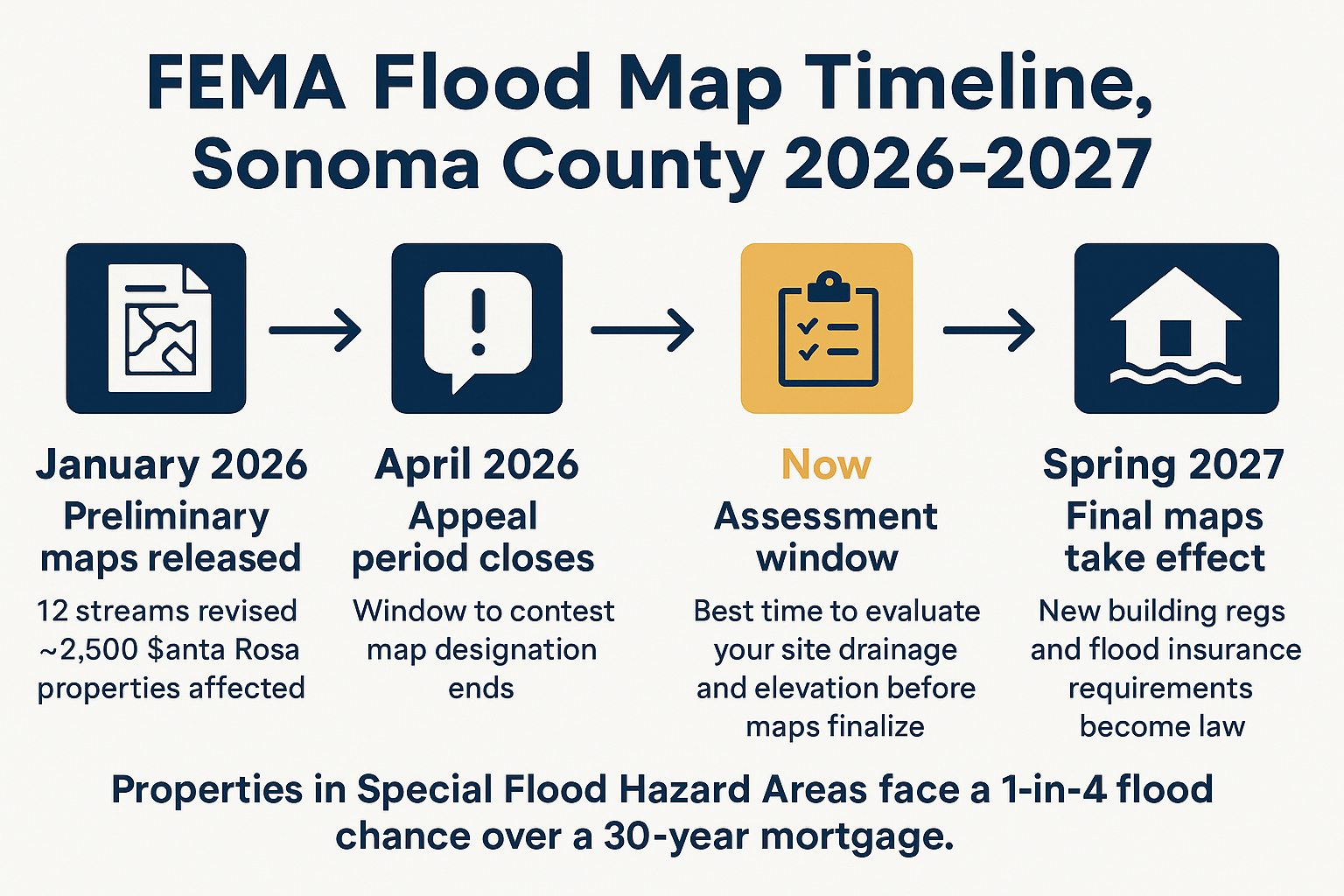
If your property is near a creek in Santa Rosa, Bennett Valley, or the unincorporated stretches west of the city, there is a real chance FEMA’s January 2026 preliminary flood map update has changed your risk category, and you may not know it yet. Roughly 2,500 Santa Rosa properties were identified as being in high-risk flood zones following FEMA’s revision of flood hazard data along 12 streams throughout Sonoma County. The appeal period closed in April 2026, and the final maps are expected to take effect in spring 2027.
I’ve been doing site work in Sonoma County long enough to know that a FEMA map change isn’t just a paperwork event. It triggers real compliance requirements for new construction and substantial improvements, stricter foundation elevation standards, more detailed drainage design review, and grading documentation that many property owners don’t have in hand. The time to get ahead of that is before you finalize a design or pull a permit, not after.
This article breaks down what the remapping actually means for your parcel, what the drainage and grading connection looks like in practice, and what a site assessment can tell you before the final maps lock in next year.
What FEMA’s Map Update Actually Changed in Sonoma County
FEMA’s updated Flood Insurance Rate Maps (FIRMs) for Sonoma County and the City of Santa Rosa identify revised flood hazards based on current hydrological modeling. Properties designated in a Special Flood Hazard Area (SFHA), what most people call a high-risk flood zone, face a 1-in-4 chance of flooding over the course of a 30-year mortgage.
The areas most directly affected include creek-adjacent and low-lying properties near:
- Matanzas Creek in Bennett Valley
- Santa Rosa Creek west of the city
- Several unincorporated Sonoma County corridors along the 12 streams FEMA identified
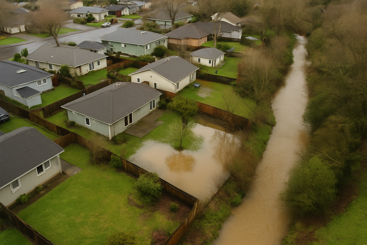
This didn’t come out of nowhere. Sonoma County entered the 2025-2026 rainy season already saturated from prior years. By early January 2026, the Santa Rosa region had recorded 15.7 inches of rain since October 1, that’s 125% of seasonal normal. The Russian River came back into flood stage near Guerneville. Those back-to-back high-water events are part of what drove FEMA to update the maps, and they’re also what’s driving homeowners on low-lying and creek-adjacent properties to take drainage seriously for the first time.
For context on what Sonoma County’s soil and slope conditions mean when water moves that fast, it helps to understand how properties in this region handle drainage under real stress.
What the New Designation Means If You’re Planning to Build or Improve
Being remapped into an SFHA isn’t just a flood insurance issue. If you’re planning new construction or a substantial improvement to an existing structure on a newly designated parcel, you’re now subject to local floodplain development regulations that weren’t on your radar six months ago.
In practical terms, that often means:
- Foundation elevation requirements, the lowest floor must be at or above the Base Flood Elevation (BFE), which may require a higher building pad than originally designed
- Drainage design review, your site’s drainage capacity and outfall will be scrutinized as part of the permitting process
- Grading documentation, you’ll need accurate as-built records showing site elevations relative to BFE
- Floodplain development permit, a separate review layer on top of standard grading and building permits
Sonoma County already requires a grading permit for any cut or fill exceeding 50 cubic yards. A flood zone designation adds compliance layers on top of that. If you’re in the early planning phase of a new build, a major grading project, or an ADU, the map change may mean your current site plan needs a second look before it goes to the county.
This is especially true if your design was drawn before January 2026, and before the new BFE data was published. I’ve seen projects stall at the permit desk because the site plan didn’t account for the flood elevation standard that was in place at the time of submission. What a site plan actually controls matters a lot more when you’re in a flood zone.
The FEMA Flood Zone Timeline: What Sonoma County Property Owners Need to Know
This timeline shows the key dates and decision points between FEMA’s preliminary map release and the final effective date in spring 2027.
The LOMA Path, and Why Your Grading Records Matter More Than You Think
Some properties that landed in the new high-risk zone don’t actually belong there. If your site’s natural ground elevation sits above the Base Flood Elevation, you may be eligible to apply for a Letter of Map Amendment (LOMA), a FEMA process that can formally remove your parcel from the SFHA designation.
A LOMA doesn’t happen automatically. It typically requires a licensed surveyor to document your site’s elevations and submit an Elevation Certificate to FEMA. For many properties, that’s straightforward. But for properties where grading work has been done over the years without detailed as-built documentation, proving your elevation can get complicated fast.
I’ve seen this play out on properties around Sonoma County where a homeowner did legitimate work, terracing a slope, regrading a drainage channel, building up a pad, but has no contractor records showing the final elevations. Without that documentation, the surveyor is working from the current surface, and if anything looks ambiguous, the LOMA application gets harder to support.
If you’ve had grading work done on a creek-adjacent or low-lying property in the last decade and you’re not sure what records exist, now is a good time to find out. The window between now and spring 2027 is the practical window to sort that out, after the maps go final, you’re already playing catch-up.
For a deeper look at how to evaluate whether past grading was done in a way that holds up to scrutiny, see how to tell if your property was graded right.
How the New Flood Zone Designation Affects Common Site Projects
Here’s a quick reference for how being remapped into an SFHA changes the compliance picture for typical projects Sonoma County property owners are planning right now.
| Project Type | Before SFHA Designation | After SFHA Designation |
|---|---|---|
| New home construction | Standard grading permit (50 CY threshold) | Grading permit + floodplain development permit + BFE compliance for foundation |
| ADU / garage conversion | Building permit + possible grading permit | Flood zone review required; lowest floor elevation must meet BFE |
| Major drainage improvements | May not require permit below 50 CY threshold | Drainage design review likely required as part of floodplain compliance |
| Retaining wall installation | Grading permit if cut/fill exceeds 50 CY | Same threshold, plus floodplain development review depending on wall location |
| LOMA application | Not applicable | Elevation Certificate required; grading as-built records support or complicate the application |
What a Site Assessment Can Actually Tell You Before the Maps Go Final
One of the most common questions I hear from property owners in this situation is some version of: “I don’t even know if I’m affected, how do I find out, and then what?”
The first step is to check your parcel against the preliminary FEMA maps, which are publicly available through the Sonoma County permit portal and FEMA’s Map Service Center. If your address comes up in an SFHA or near a revised flood zone boundary, the next practical step is a site assessment, not a full construction project, just a real set of eyes on how water moves across your property.
A good site assessment in this context looks at a few specific things:
- How water enters and exits the property during a significant rain event
- Whether existing drainage infrastructure, swales, culverts, area drains, is sized for the updated risk category
- Where the ground elevation sits relative to what the new maps show as the BFE for your zone
- Whether there are any grading conditions that would complicate a LOMA application or a permit submittal
This isn’t about starting construction. It’s about understanding what you’re working with before a design gets locked in or a permit gets submitted. For properties near Mark West Creek, Matanzas Creek, or Santa Rosa Creek, the drainage picture is rarely as simple as it looks on a flat site plan.
We’ve worked with homeowners in Santa Rosa who didn’t realize how much their property’s grading affected the way water moved until we walked the site. One property backed up to a creek and had lost significant soil to erosion each winter, the kind of situation that gets dramatically worse when you’re dealing with the rainfall volumes Sonoma County saw in early 2026. If that sounds familiar, what creek bank erosion control actually takes on a riparian lot is worth reading before you plan any site work.
For anyone thinking about drainage infrastructure more broadly, whether tied to flood zone compliance or just years of watching water pool in the wrong places, why drainage trenching fails covers what a proper install actually requires and why shortcuts in this area tend to show up at the worst possible time.
Frequently Asked Questions About FEMA’s Sonoma County Flood Map Update
How do I find out if my property is on the new flood maps?
The preliminary maps are publicly available through FEMA’s Map Service Center at msc.fema.gov. You can enter your address and see what flood zone designation applies under the updated maps. Sonoma County’s permit and planning portals also have resources tied to the remapping. If the boundary runs close to your property line, a licensed surveyor can help you determine exactly where your parcel falls.
The appeal period already closed, can I still challenge my designation?
Once the final maps take effect in spring 2027, the formal mechanism for removal is a LOMA (Letter of Map Amendment). That process is open year-round and isn’t tied to the appeal window. If your site’s ground elevation puts it above the Base Flood Elevation, a LOMA is the path forward, but it requires an Elevation Certificate from a licensed surveyor.
Do I need a permit to assess my drainage situation before the maps go final?
A site assessment itself doesn’t require a permit. You’re not moving dirt or building anything, you’re evaluating conditions. Permits come into play when you actually do grading or drainage work. In Sonoma County, that threshold is 50 cubic yards of cut or fill. Good documentation from any assessment work you do now can also support future permit applications.
We’ve had grading work done on our property before but don’t have paperwork. Is that a problem?
It can be, especially if you’re pursuing a LOMA or submitting a permit for a project in a flood zone. Reviewers rely on as-built documentation to understand what the actual site elevations are. Without it, a surveyor has to work from current conditions alone, which may be fine, or may leave questions on the table. If you’re not sure what records exist, it’s worth finding out before you get into a permit process.
We’re planning a new build in Santa Rosa. Does the flood zone designation change our foundation design?
Yes, potentially. In a Special Flood Hazard Area, the lowest floor of a new structure must be at or above the Base Flood Elevation for that location. That may require a higher building pad than your original design assumed, which affects grading scope and cost. The earlier you factor this into your site plan and grading design, the less expensive the adjustment tends to be. See what a building pad actually is and why getting it wrong is expensive for more on how pad elevation decisions affect everything downstream.
Is this just a Sonoma County issue, or should property owners in other areas be paying attention?
FEMA updates flood maps on a rolling basis across California. Monterey County has seen its own flood pressures, the 2023 Pajaro flooding displaced thousands of people and led to serious conversations about how development in flood-prone lowlands is managed. Flood zone compliance thresholds differ slightly by jurisdiction: Monterey County’s grading permit threshold is 100 cubic yards versus Sonoma County’s 50. But the underlying logic, understand your site’s drainage and elevation before you build, applies everywhere on the Central Coast.
Ready to Understand What the New Maps Mean for Your Parcel?
If your property is in or near one of the affected corridors in Santa Rosa or unincorporated Sonoma County, the window between now and spring 2027 is the practical time to get a clear picture of your site’s drainage and elevation conditions. DW Excavation works with property owners and builders throughout Sonoma and Monterey counties on exactly this kind of assessment, reading a site, connecting grading and drainage conditions to permit requirements, and helping owners understand what they’re working with before a design gets locked in. Call us at 707-601-9091 or visit dw-excavation.com to start a conversation about your property.