
Direct Answer: Most Monterey County site plans get sent back for drainage that does not reach a proper discharge point, earthwork quantities that quietly cross the 100 cubic yard grading permit threshold, and utility, access, or setback conflicts.
You turned in a site plan, waited, and it came back with red marks and a list of corrections. Now the framing crew is on hold, the loan clock is ticking, and nobody can tell you exactly how long the next round will take.
I have watched this happen on plenty of Monterey County projects, from coastal lots off Ocean Avenue in Carmel to flat parcels in the Salinas Valley. The first submittal is almost never the finish line. Every round trip through plan check adds weeks, and those weeks are where the real money goes.
So instead of a general list of plan requirements, I want to walk through what actually gets flagged: drainage, earthwork quantities, and the conflicts that hide until a reviewer overlays your plan on the real topography.
Resubmittal Is Where a Weak Site Plan Actually Costs You
A site plan does not get rejected outright very often. It gets sent back for corrections, which sounds mild until you count what a correction cycle really involves.
Here is the chain that follows one round of redlines:
- Your designer or engineer revises the drawings
- Revised sheets go back into the queue behind everyone else who submitted that week
- A reviewer reads it again, sometimes a different reviewer with different questions
- Any change to grading or drainage can pull in a second department for review
- Your excavation and framing crews reshuffle their calendars around the new date
Each loop tends to run several weeks, not several days, depending on the season and the department’s backlog. Two loops can push a spring start into the wet season, and in Monterey County that changes the whole job.
The frustrating part is that most corrections are predictable. They come from the same handful of issues, and almost all of them trace back to a plan drawn without anyone checking it against the dirt.
Drainage: The Redline I See More Than Anything Else
If I had to bet on why a plan comes back, I would bet on drainage every time. A reviewer is not just looking for arrows on a page. They are asking one question: where does the water actually end up?
Monterey County expects runoff to reach a legitimate discharge point, and to keep moving on the way there. That means a minimum slope of about one percent maintained along the drainage path, so water is not sitting in a flat run waiting to soak into the subgrade.
Here is how the check works in practice. The reviewer lays your proposed grades over the existing contours and follows the water downhill. If the plan shows a swale running at a slope that the existing topography will not support, the plan is wrong before anyone breaks ground.
The common failures I see on Monterey County plans:
- Runoff routed toward the proposed foundation instead of away from it
- Water dumped onto a neighboring parcel with no easement and no acceptance
- Discharge into a creek or drainage channel with no energy dissipation or sediment controls
- A flat run of pipe or swale that looks fine on paper but has nowhere to fall
- Roof and hardscape runoff left off the plan entirely, so the calculated volume is too low
Coastal parcels make this harder. Steep slopes above Carmel and Pacific Grove concentrate water fast, and the discharge point may be a long way downhill from where the house sits. Flat ground near the Salinas River and the Pajaro Valley has the opposite problem, where the fall you need simply is not there and the plan has to work harder to create it.
The 100 Cubic Yard Line, and Why Sonoma Owners Get Caught by It
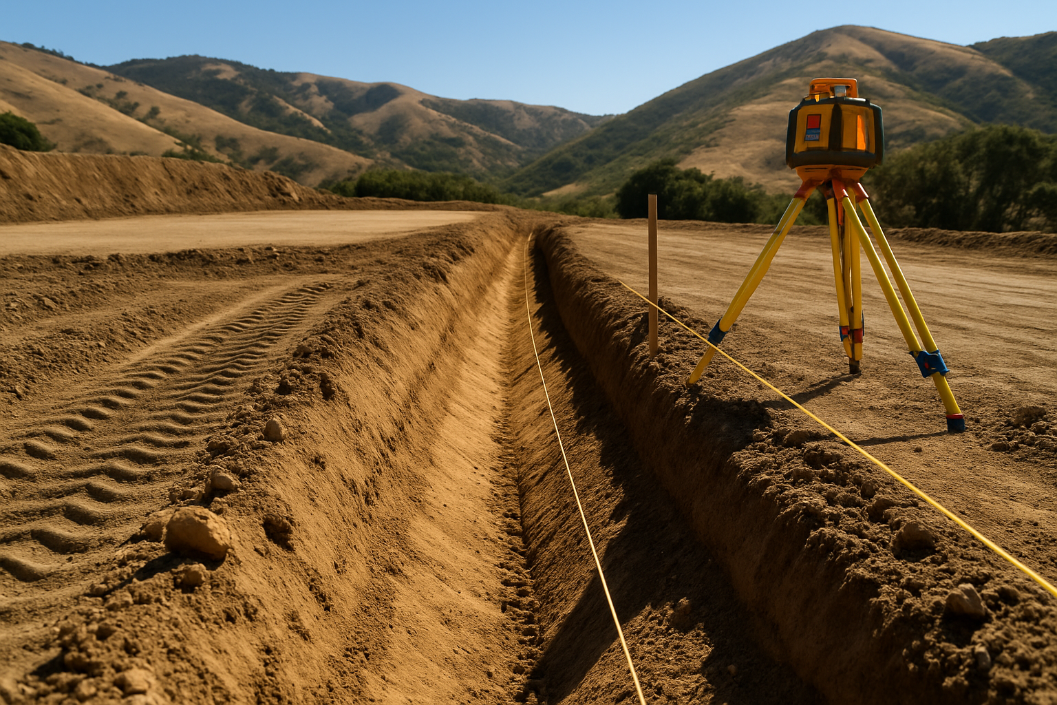
The second big trigger is earthwork volume. In Monterey County, roughly 100 cubic yards of cut or fill triggers a grading permit. Cross that line without the documentation to back it up, and the plan gets bounced.
What trips people is that 100 cubic yards is not much dirt. A modest building pad on a sloped lot, a driveway cut, and a retaining wall footing can add up past it without anyone doing the math on purpose. One property owner came to us about a Carmel site that needed a cut and grade with around 500 cubic yards of export, and that job was never going to fly without a full grading submittal.
Now here is the part that catches a lot of people on this coast. Sonoma County’s threshold is 50 cubic yards, half of Monterey’s. Plenty of the owners and builders I talk to have property in both counties and assume the rules travel with them. They do not.
What a reviewer wants to see when quantities are in play:
- An earthwork table showing cut, fill, import, and export volumes
- Existing and proposed contours that actually reconcile with those numbers
- Where excess soil goes, or where imported fill comes from
- Compaction and fill placement notes
- A soils report when slopes, fill depth, or bearing capacity call for one
If your quantities are estimated by eye rather than calculated off the grading plan, the reviewer will find the gap. And once your numbers are questioned, everything downstream of them gets questioned too. If you are curious what happens to the material itself, we broke that down in hauling off 500 yards of dirt.
Monterey County vs Sonoma County: What Changes
I get asked about this constantly by owners with land in both markets. The thresholds and the terrain problems are not the same.
| Item | Monterey County | Sonoma County |
|---|---|---|
| Grading permit trigger | Around 100 cubic yards of cut or fill | Around 50 cubic yards of cut or fill |
| Dominant soil issue | Sandy coastal soils, steep slopes, fast concentrated runoff | Clay-heavy soils that swell, hold water, and shift |
| Common drainage challenge | Long discharge runs downhill, coastal erosion, flat valley ground with little fall | Saturated clay, creek bank erosion, storm surges after atmospheric river events |
| Access review focus | Width and grade on hillside and rural driveways | Access plus wildfire defensible space considerations |
| Typical late catch | Utility conflicts and setbacks measured from the wrong line | Grading quantities crossing the lower threshold |
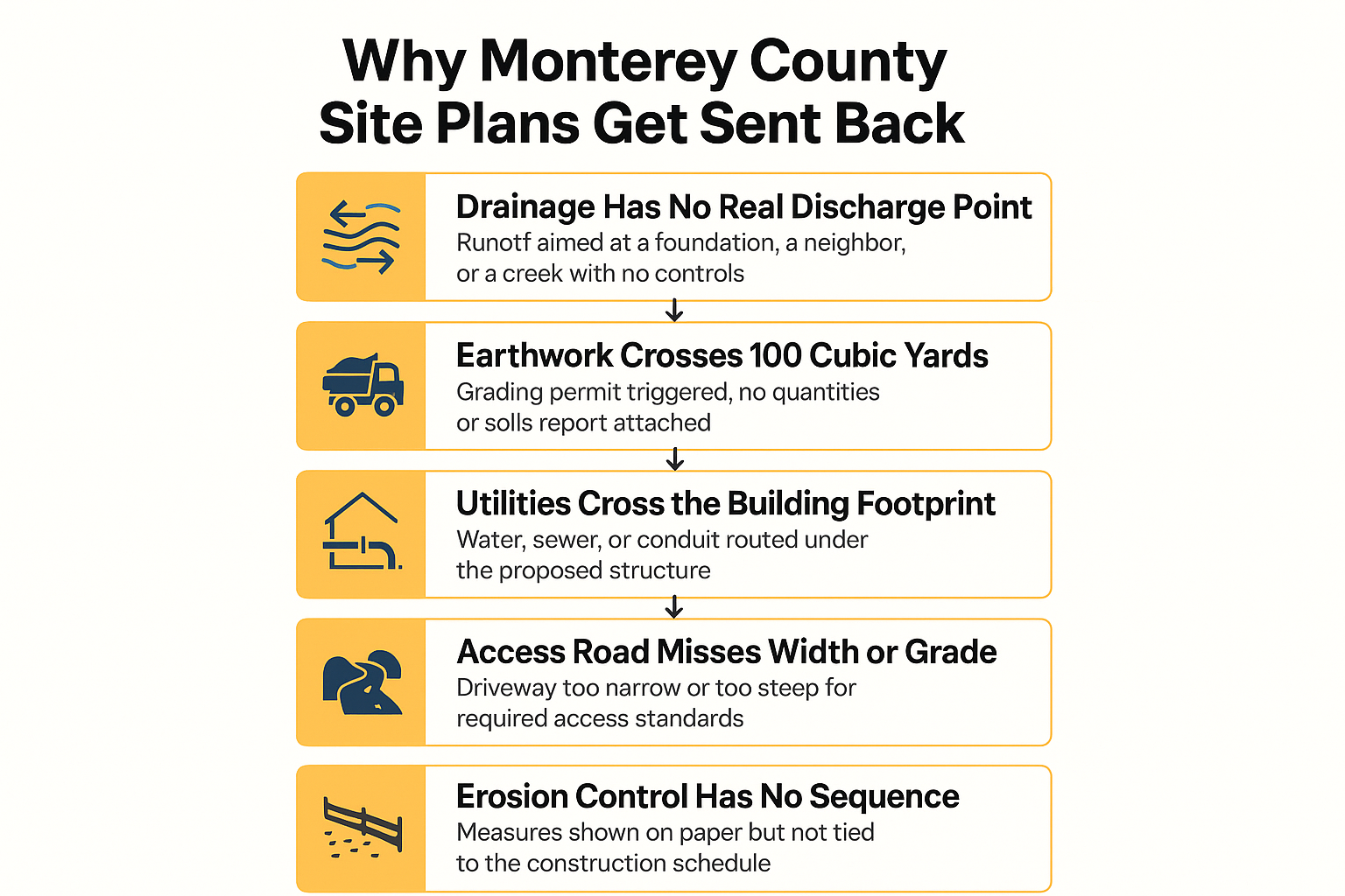
The Five Redlines That Send Plans Back
This is the short version of what I have seen pull Monterey County site plans back into correction cycles.
The Conflicts That Get Caught Late
Drainage and earthwork are the headline items. But a lot of corrections come from conflicts between things that were drawn separately and never checked against each other.
Utilities under the building footprint. The water line, the sewer lateral, or an electrical conduit gets drawn on one sheet and the structure gets placed on another. When they overlap, you either move the structure or reroute the utility, and both cost money at that point.
Access that does not meet standards. Rural and hillside parcels get reviewed for driveway width, grade, surface, and turnaround room, and the local fire authority often has a say. A driveway that climbs a coastal slope at whatever angle the ground allows tends to draw a comment.
Setbacks measured from the wrong line. This one is quiet and expensive. Measuring from an existing fence, a road edge, or an assumed property line instead of the recorded boundary can shift a whole building envelope.
Erosion control with no installation sequence. A silt fence symbol on a plan is not a plan. Reviewers want to know what goes in before the ground is opened, what stays through construction, and what happens if work runs into the wet season. In much of California, roughly mid October through mid April is treated as the rainy period, and your controls need to be in place ahead of it, not scrambled together after the first storm.
One more that shows up on trenching and utility jobs: excavation cannot legally start until underground lines are located. That is a free service through USA North 811, and it needs to be part of your schedule, not an afterthought.
The Worst Version: Legalizing Work That Was Already Built
The calls that stick with me are not the ones about plans in review. They are the ones from owners whose work is already in the ground.
The pattern is almost always the same. Someone built retaining walls and moved dirt to terrace a yard years ago, no permit was pulled, and then the city or county notices during an unrelated inspection or a neighbor complaint. Now the owner has to legalize grading and walls that have been sitting quietly for close to a decade.
At that point the path usually looks like this:
- A soils engineer, especially if the work sits on a slope
- New drawings that document what exists rather than what was planned
- A grading permit application submitted after the fact
- Possible corrective work if the existing conditions do not meet current standards
- Negotiating with an agency that already knows you are out of compliance
One homeowner described being backed into a corner with no idea what to do next, and that is honestly the right description. You have zero leverage in that conversation.
Compare that to catching the same issue on paper. On paper, a wall gets redrawn, a slope gets re-cut in the design, and the cost is a revision fee. On the ground, it is engineering, equipment, and a permit process you did not choose the timing of. If retaining walls are part of your project, what the excavation has to get right first is worth reading before anything gets built.
Why the Dirt Crew Should See the Plan Before It Goes In
Here is the pattern behind almost every correction I described above. The plan was drawn by someone who never stood on the site, and the people who would move the dirt never saw it until after approval.
A grading contractor reads a site plan differently than a designer does. We look at whether the swale can actually hold one percent across that ground, whether the cut quantities match the contours, whether the access grade is buildable, and whether the utility trench can hit required depth and separation without running under the slab.
On our projects, we handle site planning and zoning support alongside the excavation itself, and we coordinate with both Monterey and Sonoma County agencies. That means drainage, access, utility layout, and grading quantities get reconciled against real site conditions before the plan goes into review rather than after.
If you want the deeper background on the documents themselves, we covered what a site plan actually controls and whether you need a civil site plan before a grading permit in separate articles.
Getting a plan right the first time is not about drafting skill. It is about matching the drawing to ground you have actually walked.
Frequently Asked Questions About Site Plan Review in Monterey County
How long does one round of corrections add to my timeline?
It varies by department workload and season, but plan on several weeks per cycle, not days. Revisions go back into the queue, and if grading or drainage changed, a second department may need to look at it again.
Does moving dirt around my own property count toward the 100 cubic yard threshold?
Yes. The trigger is based on cut or fill volume, not on whether soil leaves the site. Terracing a yard by pushing material uphill still counts, which surprises a lot of homeowners.
If my project is under the threshold, am I in the clear?
Not automatically. Slope, proximity to a creek or drainage channel, coastal zone location, and the type of work can all pull a project into review even at low volumes. Being under 100 cubic yards means you may avoid a grading permit, not that you avoid every other requirement.
What does a grading permit cost in Monterey County?
Fees depend on the volume of earthwork, the review level, and whether engineering or a soils report is required, so the range is wide. The bigger cost driver is usually not the permit fee itself but the engineering and revision work attached to it. It is worth getting a specific answer for your parcel rather than budgeting off a general figure.
Can I just fix the redlines myself and resubmit?
Sometimes, if the comments are minor notes or missing labels. But if the reviewer questioned drainage slope or earthwork quantities, the fix usually requires someone who can recalculate against the actual topography. Patching the drawing without changing the underlying design tends to produce a second round of the same comments.
My property is in both Sonoma and Monterey County. Do the same rules apply?
No, and this catches people regularly. Sonoma triggers a grading permit at roughly 50 cubic yards while Monterey’s threshold is around 100, and the drainage, soil, and access considerations are different between clay hill country and coastal terrain.
Thinking Through a Site Plan in Monterey County?
If you have a parcel in Monterey County and you want the grading, drainage, access, and utility layout checked against real ground before it goes into review, our team handles site planning and zoning support alongside the excavation work itself. We are reachable at 707-601-9091 or through the contact page at dw-excavation.com if you would like to talk through your site and request an estimate. Whether your plan is still a sketch or already sitting in plan check with redlines on it, an early conversation usually saves a cycle.